Luconia Breakers: China’s new “southernmost territory” in the South China Sea?
Posted: June 16, 2015 Filed under: China-ASEAN, China-Malaysia, CMS (China Maritime Surveillance), South China Sea, State media | Tags: ASEAN and South China Sea, 《中国国家地理》, China Coast Guard, China Coastguard, China-ASEAN, China-Malaysia relations, Chinese foreign policy, Chinese National Geography magazine, 琼台礁, 马宏杰, Gugusan Beting Patinggi Ali, Hempasan Bantin, James Shoal, Luconia Shoal, Luconia Shoals, Ma Hongjie, Malaysia, Malaysia and South china SEa, normalized patrols, North Luconia Shoal, PRC foreign policy, PRC maritime law enforcement, Shahidan Kassim, Shan Zhiqiang, south china sea, South Luconia Shoal, Spratly, spratly islands, Wu Lixin, 单之蔷, 吴立新, 曾母暗沙 13 Comments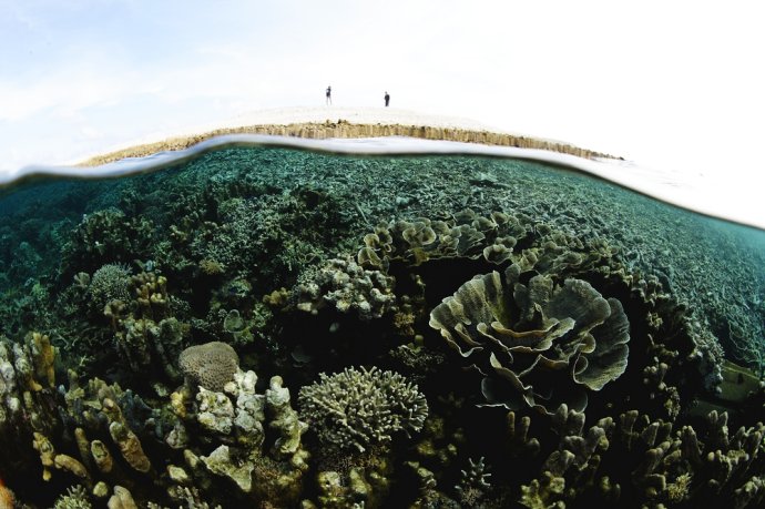
The “island” at Luconia Breakers 琼台礁/Hempasan Bantin (source: Chinese National Geography, October 2010)
In a vivid illustration of how dynamic the status quo in the South China Sea can be, an apparently new Spratly island, formed by the forces of nature, has become a source of tension between China and Malaysia.
Luconia Breakers (Hempasan Bantin / 琼台礁) is just over 100km north of James Shoal, the shallow patch of ocean that Chinese people are routinely taught is the southernmost point of their country’s “territory“, despite it being several metres underwater.
As this post will show, unlike James Shoal, the territory at Luconia Breakers actually exists above the waterline. This is significant because if the PRC ever needs to clarify the nature of its maritime claims under international law, it could end up adopting the “new” feature as its southernmost territory.
Topping off the intrigue, the train of events leading to the current Sino-Malaysian standoff may well have been set in motion by an adventurous Chinese magazine team.

